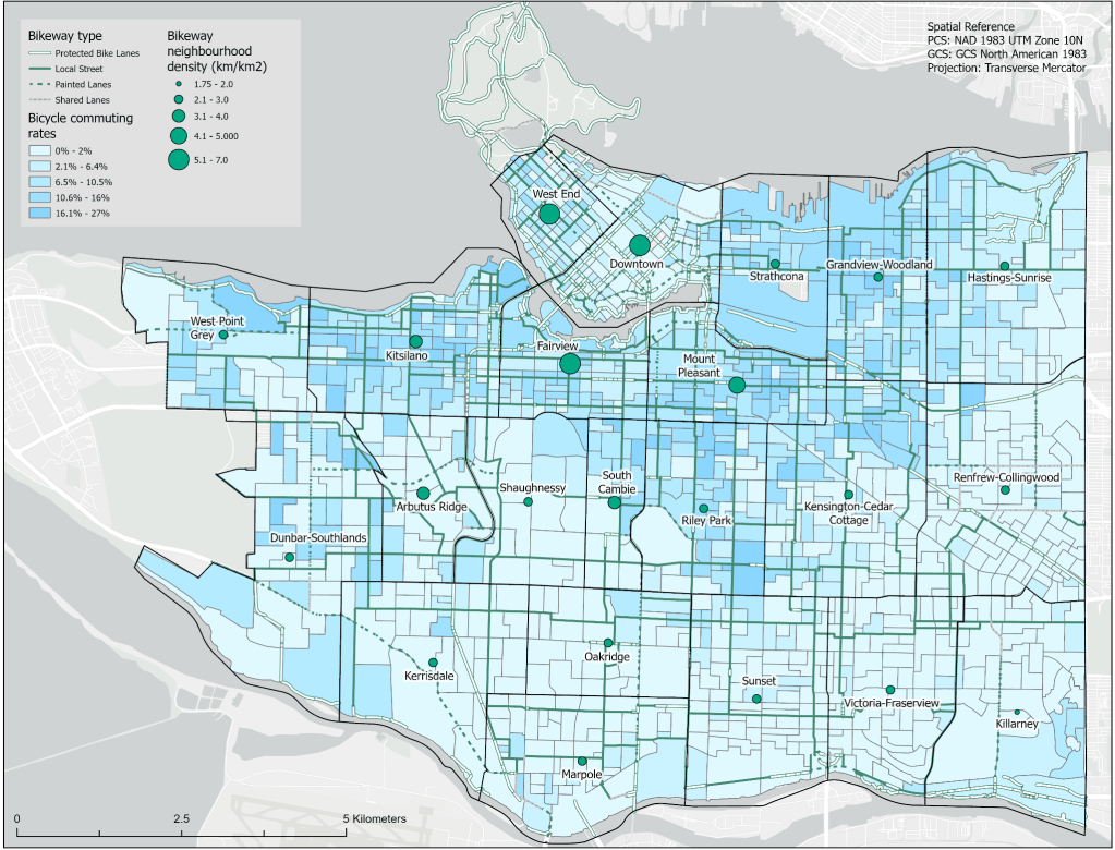
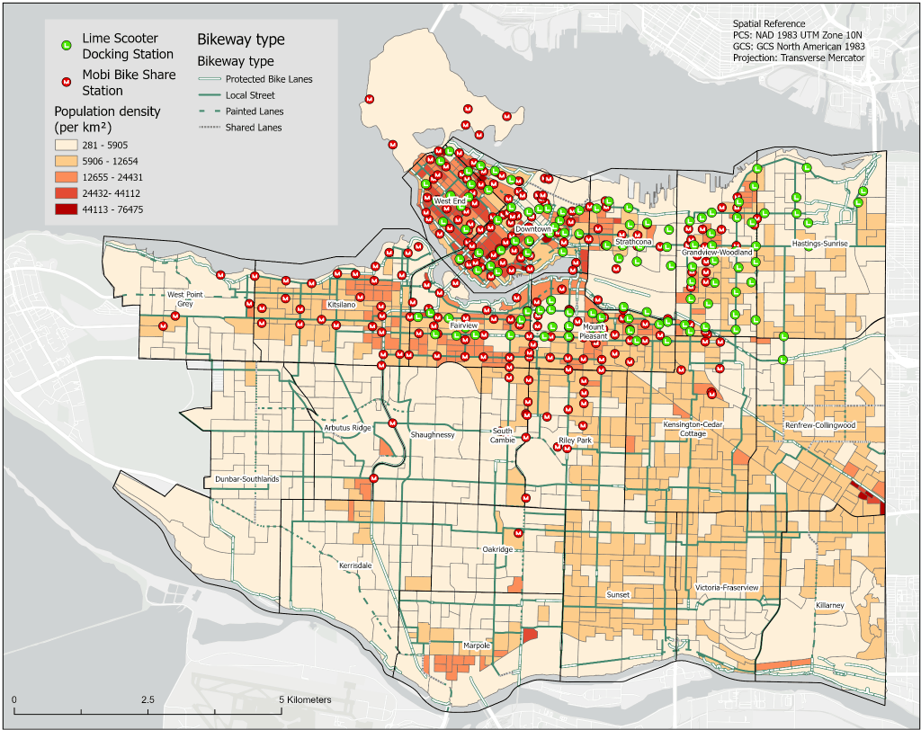
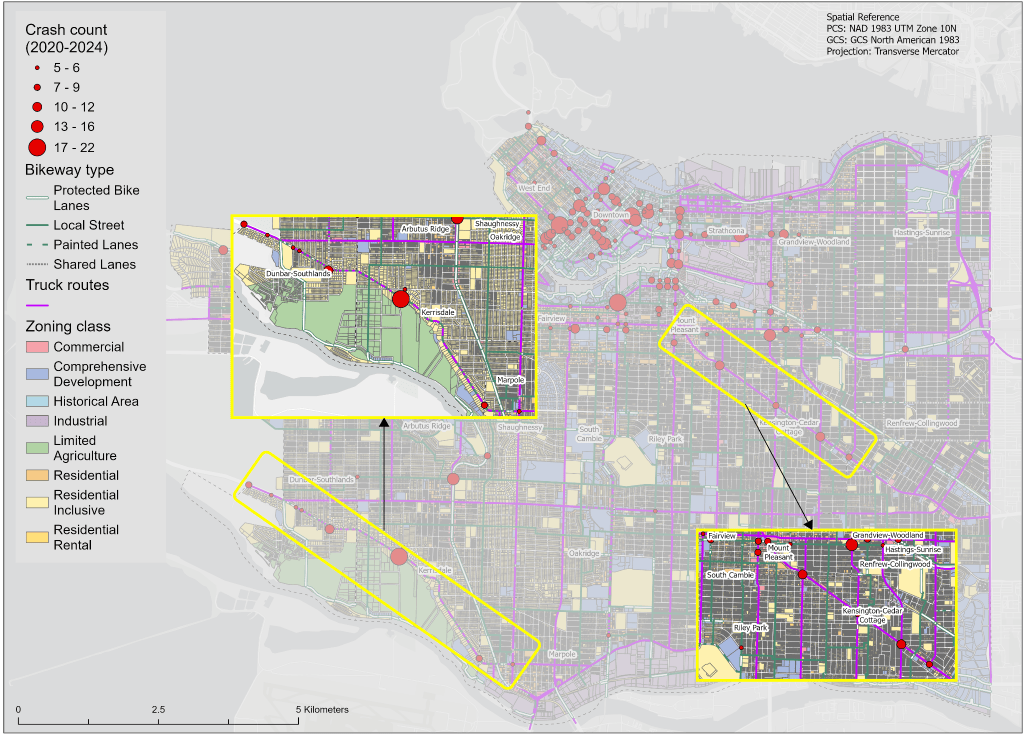
In this group assignment, we investigated potential barriers contributing to the low modal share of cycling for daily trips in Vancouver. I created three maps examining commuter habits, bike and e-scooter share programs, and cycling accidents by zoning. These maps helped identify spatial patterns and gaps in cycling infrastructure, accessibility, and safety, contributing to recommendations for making cycling a more practical, accessible, and safe transportation option across Vancouver neighbourhoods.
Through this assignment, I developed my skills in spatial analysis and data visualization, particularly in using GIS to analyze relationships between different datasets and communicate findings through maps. It also strengthened my ability to use GIS as a tool for identifying spatial patterns and supporting evidence-based recommendations.
Software Used: ArcGIS Pro


Leave a comment